
Limited Edition BSPRA Xplorer Map
Own a piece of passenger rail history. $300 — shipped directly to you.
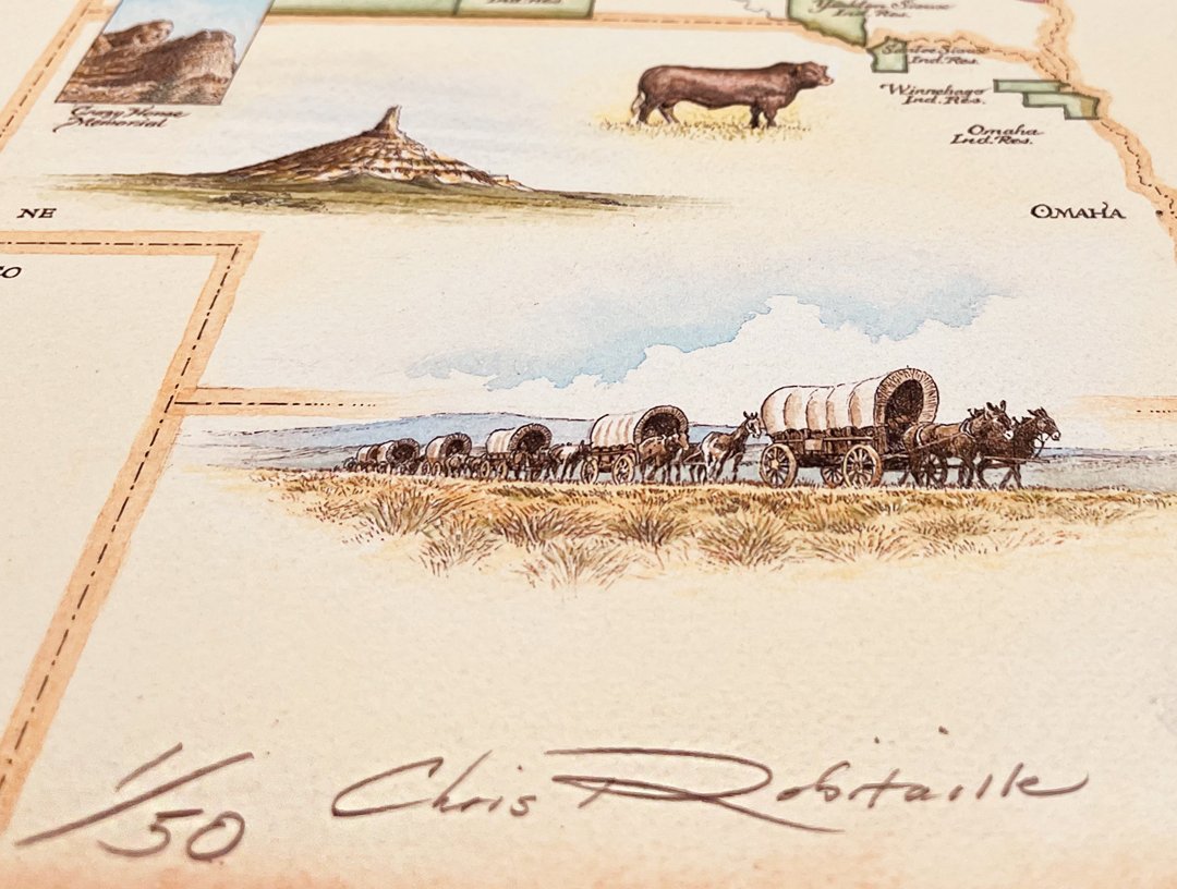
1 through 50 Limited Edition Greater Northwest Passenger Rail Fine Art Print. Signed and numbered by artist Chris Robitaille. Only a small number remain.
This collaborative partnership with the Big Sky Rail Passenger Authority is a "first of its kind" for Xplorer Maps and a custom collaborative partnership we are very excited to be a part of.
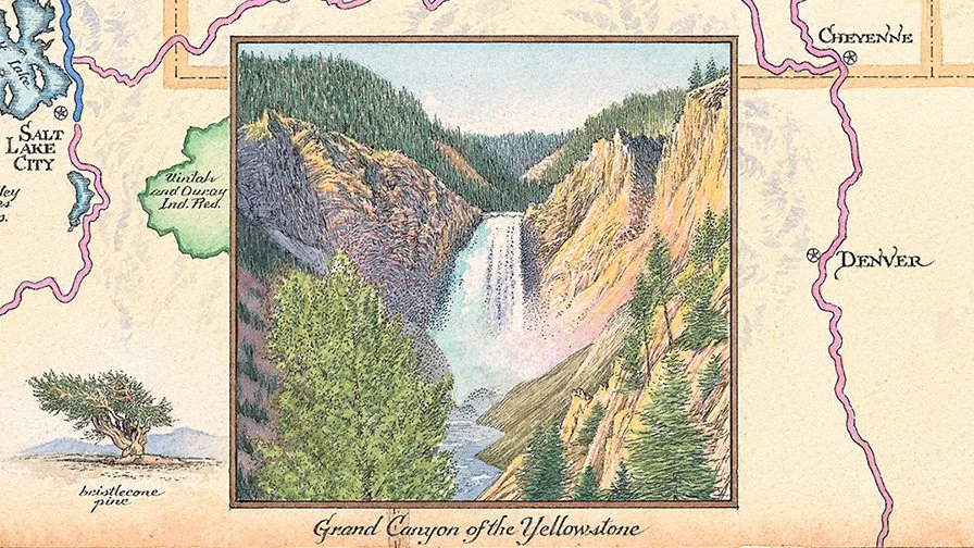
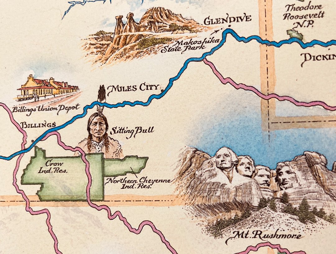
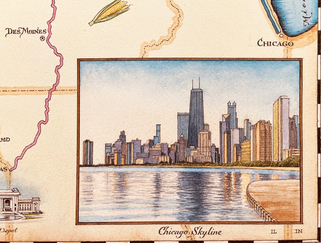
The signed original artwork was rendered using the finest pen and ink brushes and finished with multiple watercolor washes layered throughout the process. From conception to completion, the artwork took approximately 3-4 months. Every line, letter, icon, and detail is drawn entirely by hand and is unique and original to this new map.
Once the rendering of the original artwork was complete and all the digital prep and color correction process work complete and archived, Xplorer Maps printed a very limited edition run of 50 signed and numbered giclee prints to provide additional fundraising opportunities for the BSRA to generate funds and raise awareness and excitement for this project. These Giclees are printed on a 100% Museo Max ``cotton rag" heavyweight paper using no artificial optical brighteners whatsoever. This is the absolute finest reproduction print paper in the industry and is guaranteed never to fade.
There will only ever be these 50 signed and numbered limited edition giclee made available.
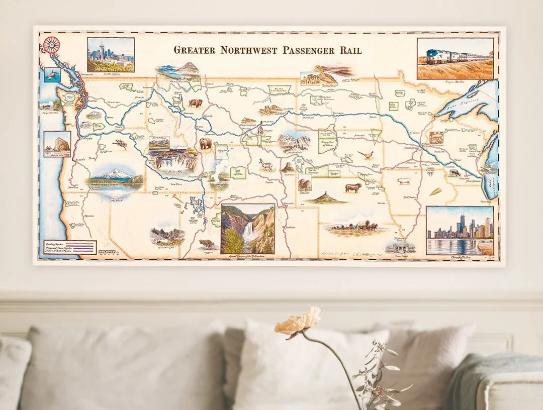
- 32.5" x 16.5"
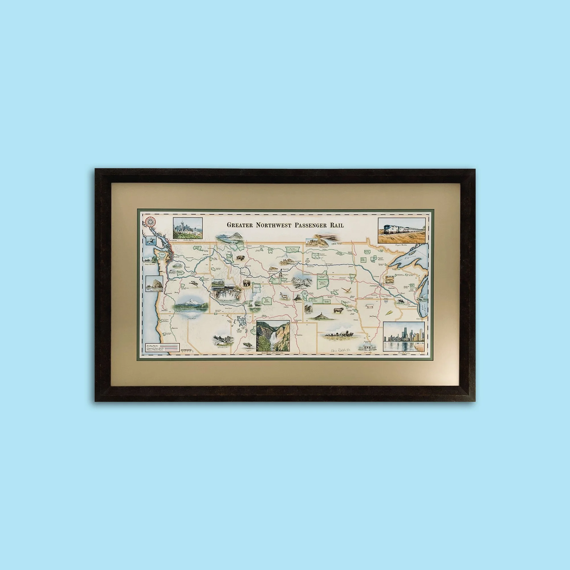
- Signed and numbered
- Not Framed
Xplorer Maps celebrates their 10th anniversary with a “Greater Northwest Passenger Rail” map collection, aiding efforts to restore passenger rail to the Northwest.
Xplorer Maps (XM) journey began more than a decade ago with two brothers-a talented, globe-trotting artist and entrepreneurial geography buff-who had a mission to create hand-drawn, antique-style maps of national parks and travel destinations that would make lasting and meaningful connections between people and place worldwide.
But Chris and Greg Robitaille were looking for more. The family-owned business wanted to form partnerships with organizations whose missions are aligned with connecting people and place, and where their fine art lends itself naturally. Xplorer Maps dedicates at least one of the six maps it releases each year to working and collaborating with Montana non-profits. And the Big Sky Passenger Rail Authority (BSPRA) was fortunate for its chance encounter at the Missoula-Made Fair which led to its selection.
As creators of the world’s finest hand-drawn maps, XM’s artistic process usually takes 12-18 months from “concept to completion”. XM and BSPRA spent months massaging content, discussing details, and making sure the contents for the rail map were exactly what the Authority wanted.
“Never before has XM turned a discussion into a map in this short of a time frame, seven months. Actual artwork takes about six weeks once everything has been decided upon; scale, scope, design, layout.” - Chris Robitaille
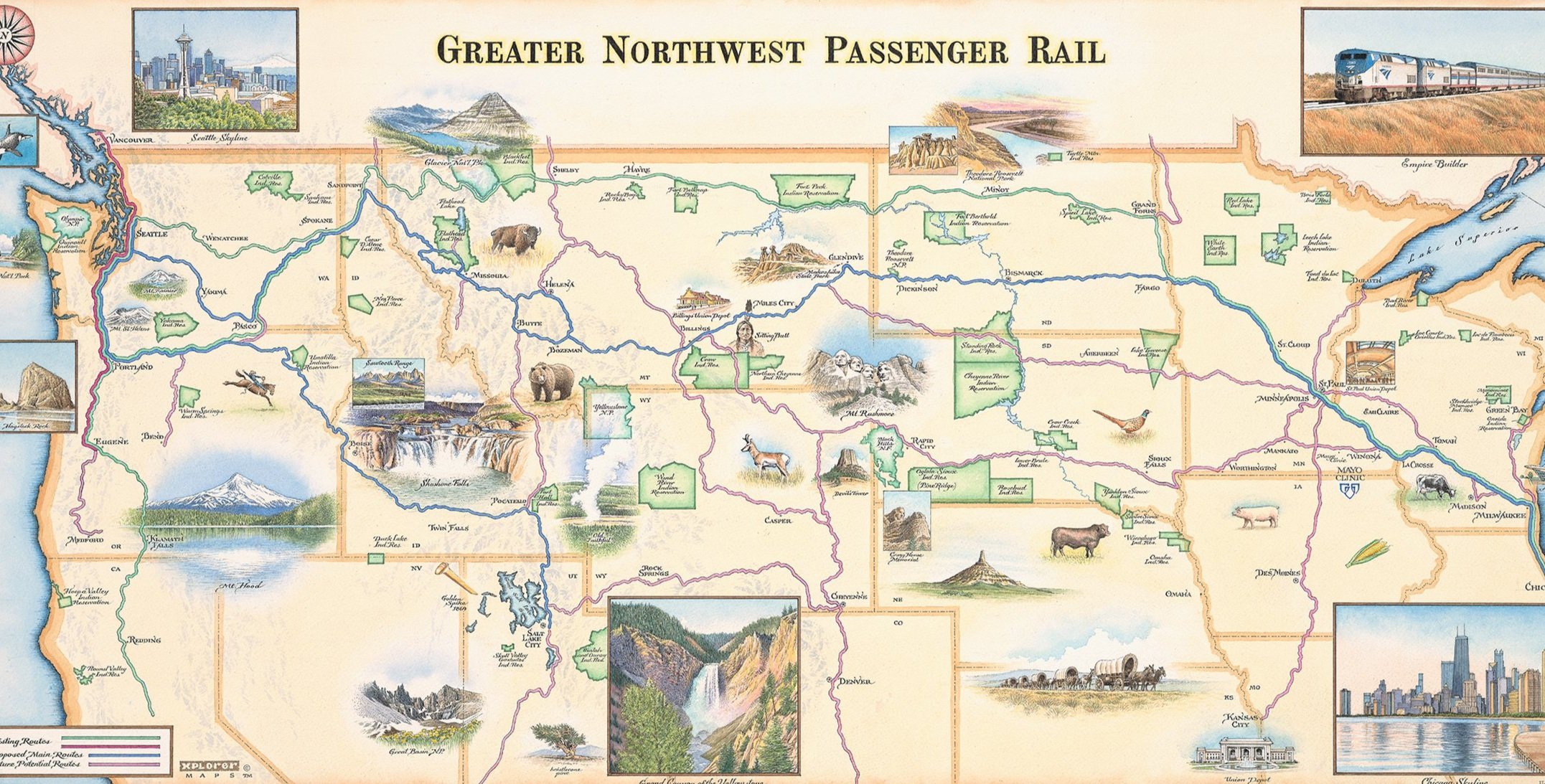
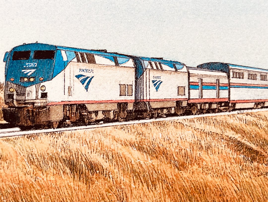
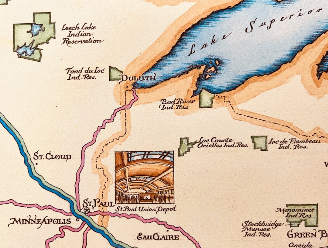
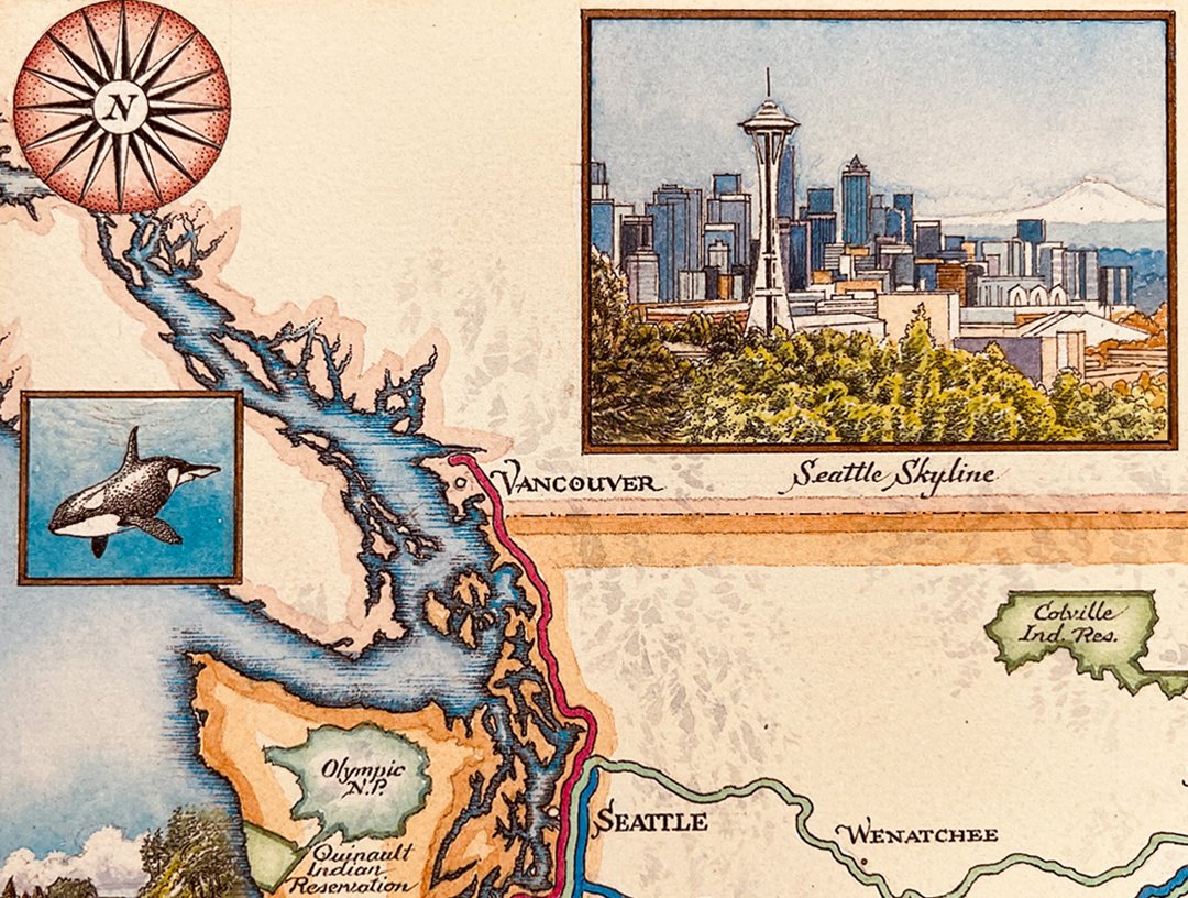
Throughout the collaborative process, our intent was to ensure that the RAIL LINES were the major focus and that the supporting illustrations simply augmented the story and highlighted the regional differences bringing everyone together toward a common goal.
The end result is a unique piece of art that effectively "tells the story" of the Greater Northwest Passenger Rail project, generates enthusiasm, and supports the passion of everyone involved.
Double click video to view full screen.
“We believe that this original fine art piece beautifully reflects the great expanse and significance of the greater northwest and will generate public interest in expanding passenger rail in Southern Montana, the greater northwest, and beyond. We are so grateful for the generosity of Xplorer Maps and its founders, Chris and Greg Robitaille."
Dave Strohmaier, Chairman of the BSPRA
Xplorer Maps is a registered Made in Montana business that uses exclusively 100% post-consumer content paper produced with 100% green energy and chlorine-free soy-based inks. Since they began 10 years ago, Xplorer Maps has donated more than $100,000 to 37 different organizations dedicated to the education and conservation of our Public Lands. The original artwork has been donated to the Big Sky Passenger Rail Authority.